Measuring the extent of Madagascar’s wildfires

January 12, 2024

Two decades ago, in my book on fire in Madagascar published at the University of Chicago Press, I made an educated guess that “in grasslands, roughly one-quarter to one-half of the surface burns annually“. A footnote fills over half of the page to justify my estimate, drawing from local studies, observations, government statistics, and rudimentary satellite data. I am thrilled to report that a just-published study confirms this estimate and makes it more precise, finding that 32% or so of the grasslands burn each year. The study takes advantage of newer satellite images that are more frequent and higher resolution to make its estimates, catching smaller and more ephemeral (quickly regreening) fire patches. Congratulations to Víctor Fernández-García on leading this work, funded by a Swiss Network for International Studies grant.
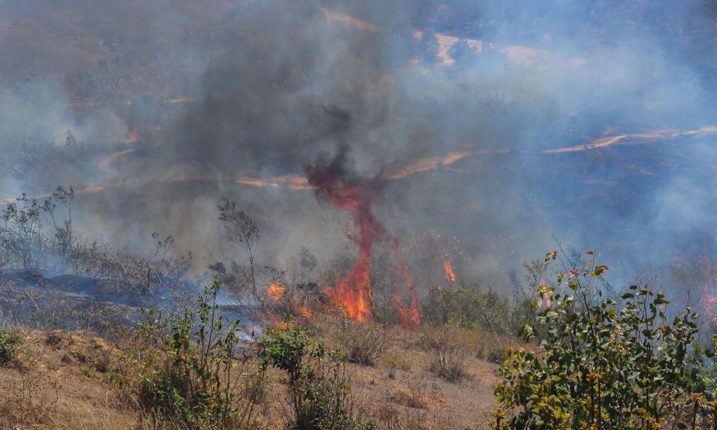
Fire in the highlands (photo: YK, 2018)
Read the rest of this entry »

New project: what type of fire regime for what type of benefit (carbon, biodiversity, livelihoods…) in Southern Africa and Madagascar

October 13, 2022
Field burning near Beira, Mozambique (C. Kull, 2010)

I am happy to announce that we have received funding from SNIS (Swiss Network for International Studies) for a new project. Principal member of the project is fire ecologist and remote sensing specialist Víctor Fernández-García, with collaborators at the universities of Antananarivo, Eduardo Mondlane, Swansea, Lausanne, and Léon, and at FAO and SANParks.

Read the rest of this entry »

Madagascar’s fire regimes compared to the rest of the tropics

June 15, 2022

Bushfire is often seen as symbolic of environmental catastrophe on Madagascar. But is it? A global comparison of fire regimes based on satellite image data suggests care in jumping to such conclusions. A recent article in Global Change Biology, led by Leanne Phelps and to which I contributed, finds that the island’s fire regimes have analogues to 88% of fire regimes in the global tropics with similar climate and vegetation. Madagascar’s fires, while exceptionally vilified, are not exceptional. It also demonstrates that the large, landscape-scale grassland fires common across highland and western Madagascar have no relationship to forest loss; indeed forest loss occurs in places without large-scale fires.

Figure 3 from Phelps et al. (2022). Colours represent areas with similar fire regimes (clustered based on burnt area, fire size, seasonality, and numbers of fires). Black pixels represent fire regimes not found on Madagascar. Gray pixels are places without landscape-scale fire regimes. Photos: (a) tapia branch and chameleon at Ibity, (b) uncontrolled, peri-urban landscape fire in Ambositra [photo C. Kull, 2019], (c) a forest-savanna boundary in Ambohitantely, (d) ancient biodiverse grasslands on Ibity, (e) landscape fire in an agricultural region near Ambositra, likely for grassland renewal [photo by C. Kull, 1998/9], (f) tree cover on a forest-savanna boundary in Ambohitantely, (g) smallholder land use on Ibity.
Read the rest of this entry »

Why we can’t say Madagascar is 90% deforested

April 25, 2014

If stated often enough, a fact becomes truth. That seems to be the case with the oft-repeated figure that “Madagascar has lost 90% of its original forest cover”. The problem, as Bill McConnell of Michigan State University and I point out in a letter just published in Science magazine, is that this fact cannot be proven.

Slash-and-burn tavy clearing near Andapa, Madagascar © 1994 C. Kull

Slash-and-burn tavy clearing near Andapa, Madagascar (photo by C. Kull)

Read the rest of this entry »